Insured losses in 2025 broke the $100 billion barrier for the sixth consecutive year — a number that has long been considered a measure of escalating natural catastrophe risk. Without a major U.S. hurricane landfall, however, losses came in below the average incurred during the past decade. While the market may take a moment to exhale, context is crucial. A below-average loss year is not an anomaly; statistically, it is the expectation. Because catastrophe risk is heavily skewed by tail events, the average will always be driven by a handful of very active years, leaving the majority of years falling below the mean.
What makes 2025 stand out is that losses were modest despite the backdrop of elevated hazard potential. Sea-surface temperatures in the North Atlantic have been among the warmest on record, while global mean temperatures continued to test the upper bounds of the satellite era. Exposure concentrations in hazard hotspots are higher than ever, and rebuilding costs continue to rise. The ingredients for large losses were present in 2025, yet the atmosphere chose not to combine them.
This situation is best described as transient meteorological luck: the temporary alignment of atmospheric and oceanic conditions that suppresses loss activity without altering the underlying risk. A quiet year does not signal that the underlying hazard or vulnerability has reduced. Rather, it represents a fortunate gap in natural catastrophes. When viewed through this lens, 2025 stands out as a moderate loss year in a high-risk situation.
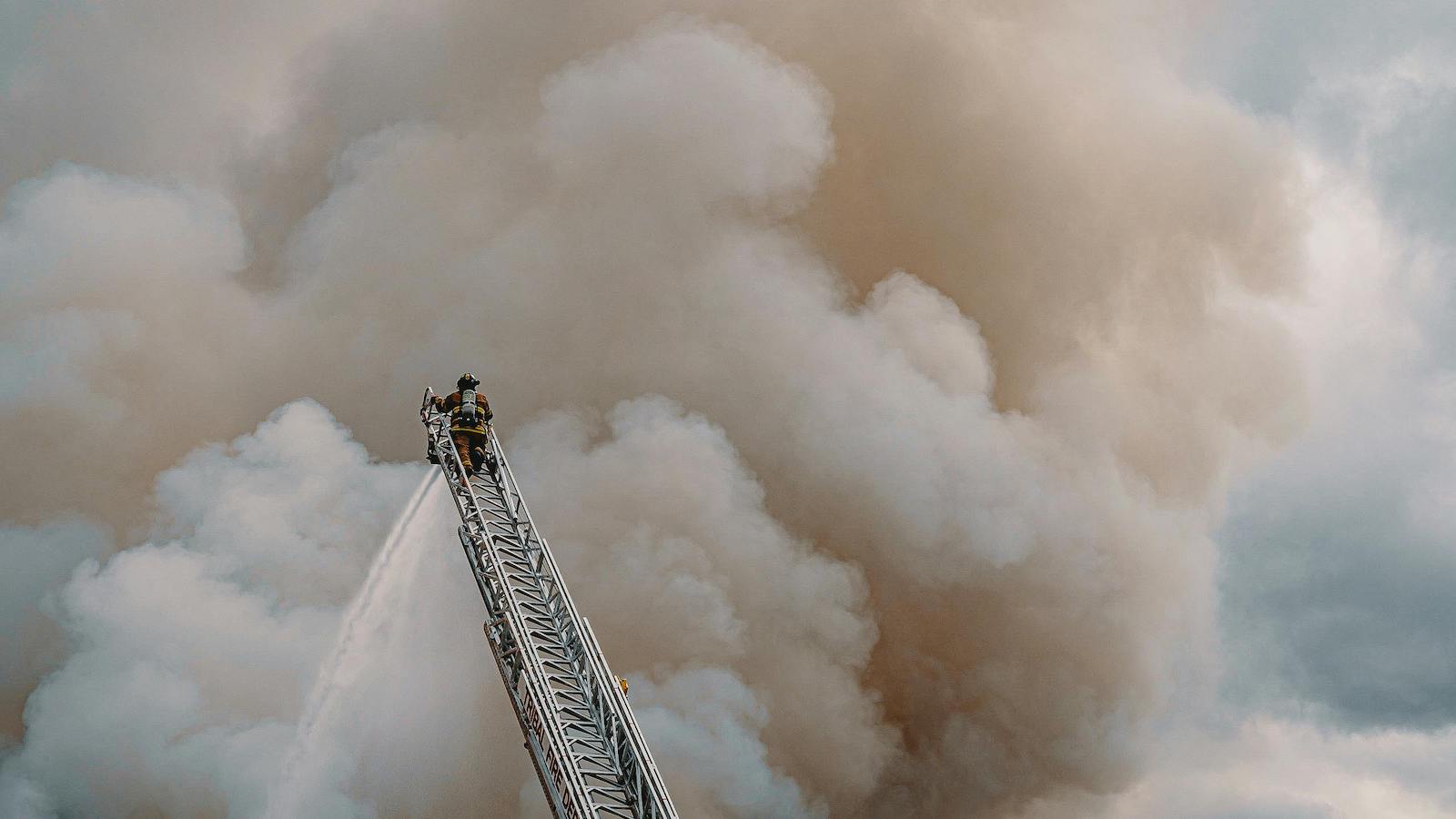
While 2025 was the first year in a decade where no hurricanes made landfall in the United States, other places were not so fortunate. Hurricane Erin followed an eastward track well away from the Caribbean but still delivered heavy rain to Guadeloupe and Puerto Rico and high winds to the Bahamas. Hurricane Imelda passed directly over the northern coast of the Dominican Republic and Haiti and brought heavy rains and severe flooding to both countries. The storm also caused heavy rain and landslides in Cuba and strong winds (with gusts up to 100 miles per hour) over Bermuda.
The most consequential event of the past season was Hurricane Melissa, which made landfall over Jamaica on Oct. 28 as a Category 5 storm. It was previously uncommon for major hurricanes to form in October, but as the North Atlantic has warmed, the environmental conditions that are favorable to hurricane formation are lasting later in the year. And that same warming also allows storms to become much stronger very quickly. Compared with the late 20th century, the number of storms undergoing "explosive" intensification (winds strengthening by almost 60 miles per hour in less than a day) has almost doubled.
Long term, the climate is warming, which continues to load the dice toward greater volatility and more complex extremes, from wildfire behavior outside historical norms to record rainfall and the rapid intensification of tropical cyclones. Even if the financial tallies appear muted, the physical risk remains on an upward trajectory.
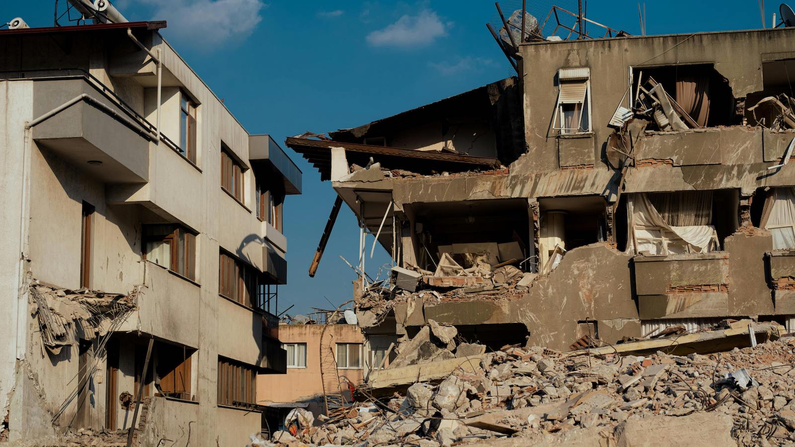
For example, future wildfire losses in California are likely to exceed what recent fire footprints suggest. Fires can now occur across more of the year, more people and assets are located in flammable areas and rebuilding is materially more expensive. With much of the state's high-value wildland-urban interface yet to experience fire under these conditions, historical loss experience alone is no longer a reliable guide for pricing or portfolio steering.
Meanwhile, flood events in 2025 illustrate the accelerating trend of hydrological intensification driven by continuing global warming. A preliminary global review shows extreme and often record-breaking rainfall on every continent, with many events producing exceptional sub-daily intensities. Crucially, severe flooding is increasingly occurring in locations not historically classified as high risk, prompting renewed scrutiny of exposure and preparedness.
Recent flooding illustrates how once-in-a-lifetime events are now occurring in rapid succession. The United States' Texas Hill Country floods, with more than 500 millimeters of rainfall in two days, exemplified this shift, resulting in substantial loss of life and revealing gaps in emergency response and insurance coverage. Further evidence of this intensification has been seen in Pakistan, Spain and elsewhere. The persistence and clustering of such extremes align with trends clearly established in 2023 and 2024. Climate change is increasing rainfall intensity and expanding flood hazard footprints, while societal exposure continues to outpace preparedness.
Quiet years often breed a false sense of security. The 2006–2016 drought of major hurricane landfalls in the U.S. created an illusion of reduced risk. But the inevitable return of high-impact events in 2017 (including hurricanes Harvey, Irma and Maria) taught us that lucky streaks always end. As the reinsurance market softens, the temptation to chase premium can erode discipline, leading to the silent accumulation of risk. In this environment, strong scientific judgment, rigorous model evaluation and robust exposure management frameworks will be essential safeguards.
Now is the time to dig into the data. Leveraging research to develop bespoke views of risk, such as climate-conditioned event sets or vulnerability functions based on recent claims experience, allows cedents to distinguish portfolio resilience from temporary good fortune. Today, (re)insurers increasingly expect not only robust numbers from models, but also a transparent account of the science and limitations behind them.
Meteorological luck can delay the inevitable but does not offer lasting protection. The question is whether the industry uses this pause to relax or to prepare for when the pendulum inevitably swings back.