In 2006, UCLA Professor of Urban Planning Donald Shoup compiled the results of 16 surveys carried out between 1927 and 2001 on the time spent looking for a parking space. He reported that the average time spent looking for on-street parking was approximately eight minutes - a figure that has remained relatively unchanged since the 1930s.
This research also demonstrated that, on average, one vehicle in three in traffic is actually searching for somewhere to park. This figure has been confirmed more recently by a study from the San Francisco City Council, which concluded that an estimated one-third of weekday traffic was because of drivers looking for a parking space.
While solving the problem of road congestion via accurate traffic information has been looked at for decades - the RDS TMC protocol was invented in 1988 - and has already reached a good level of sophistication and accuracy, solving the parking problem via connected services is quite a recent topic and is still very much a work in progress.
As a matter of fact, most pure players in this field have been founded quite recently: as an example, JustPark in 2006; Parkopedia, ParkMe, Worldsensing and Anagog in 2009; and Parknav in 2011. The only companies to have emerged earlier are the parking payment companies, PayByPhone and Parkmobile, in 2000 and Pango in 2005.
On-Street and Off-Street
Parking essentially divides in two markets with two very different problems to solve: off-street and on-street. Connected services taking care of off-street parking are now quite advanced. In the three steps of information, booking and payment, the first is largely available (even if real-time data remains partial), but booking and advanced payment are still works in progress. Very few cars on the road today - or navigation apps - are able to find, book and pay seamlessly for a parking space in a garage.
The on-street parking problem is, by nature, more difficult to solve because detecting free parking bays in real time, at scale is complex and requires many sources of information. There are very different approaches to create this data.
Leveraging Traffic Probe Data for Parking
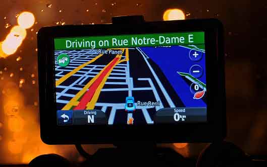
One is to make sense of the existing probe data currently used for real-time traffic. For example, Garmin is using this data to calculate the inflow and outflow of cars for each road segment in large cities and estimate availability (read here). The company has partnered with Parkopedia to include off-street parking information in their data model.
The GPS company launched this service in their mobile app during the third quarter in six German cities and is now adding cities in more countries: London, Amsterdam, Vienna and a few others coming in the U.S.
Inertial Data From Smartphones
Detecting parking and "unparking" events through inertial sensor data from drivers' smartphones is another approach used by Anagog, which built a software development kit now embedded in several million apps (watch here). Through a signal processing algorithm, the company detects out of gyroscope, accelerometer and location data (GPS, etc.) parking events that are fed to a big data cloud that is now nearing 1 billion historical parking events.
Data From Car Sensors
Car makers such as Volkswagen (read here) or General Motors are also looking at producing data using car sensors.
In the case of Volkswagen, a pilot launched by the company uses the existing ultrasonic proximity sensors (used for parking) to assess the availability of free parking spaces on the side of the road when the car drives along a street. The data is uploaded in real-time and matched against map data to eliminate false positive (parking space for disabled people, etc.).
Parking Meters
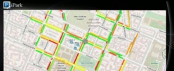
Using data from on-street parking meters is another opportunity to get real-time, on-street parking information. Because a significant number of these meters are connected to the cloud, it is possible to build predictive data based on historical trends. Parkeon, a worldwide leader in parking meters, is among the companies enabling that opportunity and rendering this data through a mobile app, Path To Park (read more here), which is now available throughout France and in a number of cities in the U.S. and Germany.
Street-Based Sensor Infrastructures
Lastly, companies such as Worldsensing are placing sensors on each parking bay in the street, which obviously provides the most accurate data, but at a cost. Worldsensing, based in Barcelona, just closed a series B round of funding (for an undisclosed amount). Its largest deployment to date was in Moscow, where the company covered 13,000 spots. The next stage of the deployment will include more than 50,000 sensors.
Image processing is also a technology that could be used to sense free parking bays in streets. Data from fixed CCTV (used for security or traffic monitoring), smartphone apps, connected dash cams or even cars could be used for that purpose.
Obviously, the best information will come from the aggregation of these data streams (historical and real-time). Inrix, which announced in June that it will supply on-street parking data to BMW, combines data from cities, mobile payment companies, real-time parking data, connected car-sharing services and Inrix's database of real-time vehicle GPS data (read here).
Parknav, a start-up based in the U.S. is also using a very diverse set of data (car-sharing, telecom, fleet, crowd-sourcing), including POI data (bars, schools, etc.) to infer probabilities about parking availability.
Accurate information about free on-street parking bays is a complex matter that will take many more years to solve, but the opportunities are huge for the whole car industry and beyond. The first opportunity is the time saved for drivers and the alleviation of stress and frustration. Once this first opportunity will be realized for drivers, its overall social impact will be big: less traffic, less pollution, less money spent on fuel.
Unused Parking Inventory
The last market opportunity in smart parking is to further eliminate barriers between the offer and the demand, between people circling in streets and empty parking bays, in enabling yield management of underused private parking inventory.
Residential buildings, companies, hotels, schools, hospital or churches have parking spaces that are empty or partially used during workdays, nights and weekends, vacations, etc. Companies like JustPark (UK) or Zenpark (France) are targeting this segment using connected technologies to unlock the value of this inventory and grow the total parking spots available.
On Jan. 28 in Brussels, the ConnecteDriver conference, in partnership with consulting firm Inov360, will gather the brightest minds and the most innovative companies to discuss the fascinating topic of smart parking:
- Hans-Hendrick Puvogel, COO at Parkopedia
- Anthony Eskinazi, head of product and co-founder, JustPark
- William Rosenfeld, CEO, ZenPark
- Bertrand Barthelemy, president of Parkeon
- Ruth Portas, sales manager, Worldsensing
- Ofer Tziperman, CEO, Anagog
- Martin Treiblmayr, product manager, Garmin
- Vincent Pilloy, co-founder and CEO, Inov360
- Parknow (speaker name to be confirmed)