Extreme weather caused 18 disasters in the U.S. last year costing $165 billion in damages, $10 billion more than the 2021 total, making 2022 the third-most-costly year since records of major losses began in 1980.
Insurers need deeper, more detailed insights into individual properties to underwrite accurately. Advanced technology can provide high-resolution satellite imagery of residences, allowing for desktop analysis of individual properties. By applying machine learning and AI technology to this aerial imagery, insurers can assess risk factors and, when necessary, quantify damage with increased efficiency and speed. High-resolution aerial imagery has the potential to bring data to life, helping insurers to competitively and sustainably underwrite properties.
Climate Change and Insurance
Using aerial imagery analytics within insurance has a range of benefits. It can be particularly useful when surveying properties that are hard to access, for example rural or coastal residences. Risk factors can instead be measured at a distance. High-quality images can contribute important property condition elements to quoting and renewal underwriting, ultimately saving businesses time, money and resources.
One major risk factor that influences the underwriting of a property is roof condition. Roofs are particularly vulnerable to constant wear and tear, as well as potential hazards, such as overhanging trees. These are also major impact areas during damaging weather catastrophes such as storms, tornadoes and hurricanes. Roof claims caused by severe weather are sometimes filed a year or more after the storm has passed. As a critical underwriting attribute, it is essential that the assessment process is accurately informed to ensure the client is completely covered for any damage. Current manual methods of assessing risk are outdated, relying on historical data that is often inaccurate and inefficient. However, with the assistance of modern aerial imagery technology, more robust data for each residential property can be ascertained. Damage from extreme weather has individual consequences for specific locations, thus, more granular data such as building elevation and soil conditions also need to be taken into account.
Aerial imagery can highlight potential hazards and capture how the roof condition is changing. An aerial perspective can also identify expensive attachments, like solar panels, as well as differentiate various materials, from shingle, tile, concrete or metal. The gradient, shape and surface area or the roof can also be pinpointed. This information can be combined with location-specific weather data, roof replacement cost estimates and claims insights on surrounding residences to help manage risk and ensure accurate underwriting. As a critical property underwriting attribute, aerial imagery can be used to collect specific and unique data points on the roofs of properties to ensure full and competitive insurance coverage.
Extreme weather events are categorized within the insurance industry as "low-probability, high-consequence," but the probability is only rising, meaning so, too, are the consequences. As threat levels dramatically increase, underwriters are under more pressure than ever to undertake new approaches and better modeling to underpin their decision making.
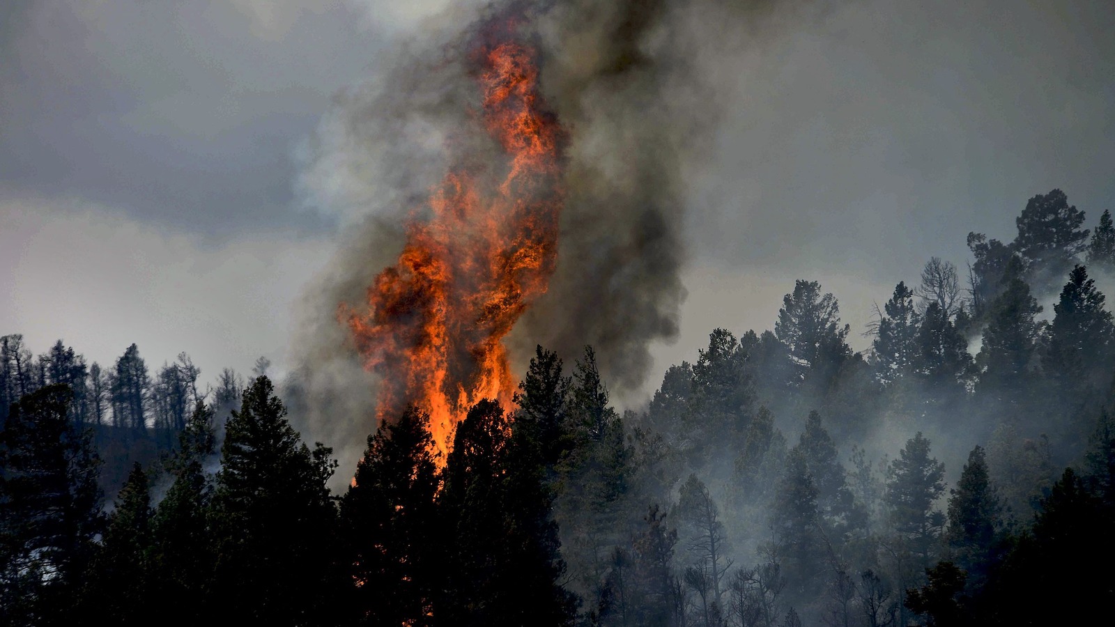
Another key factor insurers must consider when underwriting properties within a landscape dominated by climate catastrophe is wildfire risk and damage. Between 2021 and 2022, wildfires accounted for over $11.2 billion in damage across the U.S. Areas in the West, such as California, Nevada and Arizona, which suffer from long stretches of arid climate and little rain, are especially susceptible to wildfires. Wildfire damage is particularly hard to predict and measure as it is incredibly data-intensive and the risk profile can vary widely.
What is therefore required is up-to-date, location-specific data points that survey the topography of the landscape to identify areas of wildfire susceptibility. Action points can then be taken to reduce risk of damage, such as removing or trimming thick vegetation. Vegetation is identified on aerial visuals by its relatively consistent shape, color and texture. As a result of its low height, vegetation does not portray any shadow, and its variance in texture makes it detectable from the sky.
Aerial imagery can also reveal property elevation, as well as characteristics such as the defensible spaces between structures, vegetation and potential fuels in high-risk fire hazard areas. By using this data, insurers can not only assess which properties are prone to fire damage and are susceptible to wildfire risk, they can also understand which properties would need to be evacuated in the case of a climate disaster. This can be reflected in both their underwriting as well as in community disaster plans and future building regulations.
See also: Global Trend Map No. 4: Industry Health
Accurate Data Collection and Aerial Imagery
Moody’s Risk Management Solutions estimated there were $67 billion in insured losses from Hurricane Ian, which hit Florida at the end of September. Before the storm, the Florida insurance market was already in a precarious state following a recent spate of insurance company insolvencies over the past couple of years. Earlier in the year, six Florida property insurers had already declared themselves insolvent amid widespread financial problems within the industry.
Furthermore, Hurricane Ian was the most devastating hurricane since Hurricane Katrina in 2005. Officials have said this was down to a lack of preparation, not serving evacuation orders fast enough and a suboptimal approach to defending key infrastructure. This is why better data analytics and modeling is needed: so both insurers and their customers can better prepare for climate disaster through more accurate predictions about their properties.
In delivering damage reduction action points, insurers, reinsurers and brokers can sustain insurability and reduce losses for themselves, their customers, wider communities and the insurance industry as a whole.
Aerial imagery is one of the ways in which insurers can raise the standards of reliable, cost-efficient property data. It has the potential to enrich underwriting through identifying each properties unique risk factors.
By undertaking an integrated approach, combining high-quality images with expert interpretation, insurers can more confidently assess risk and underwrite profitably and sustainably. In the light of the climate disaster, insurers, now more than ever, need to adapt and update their methods of operation and delivery to keep the insurance industry afloat.